

Muktinath Weather in September 2026: Rain & Temperatures

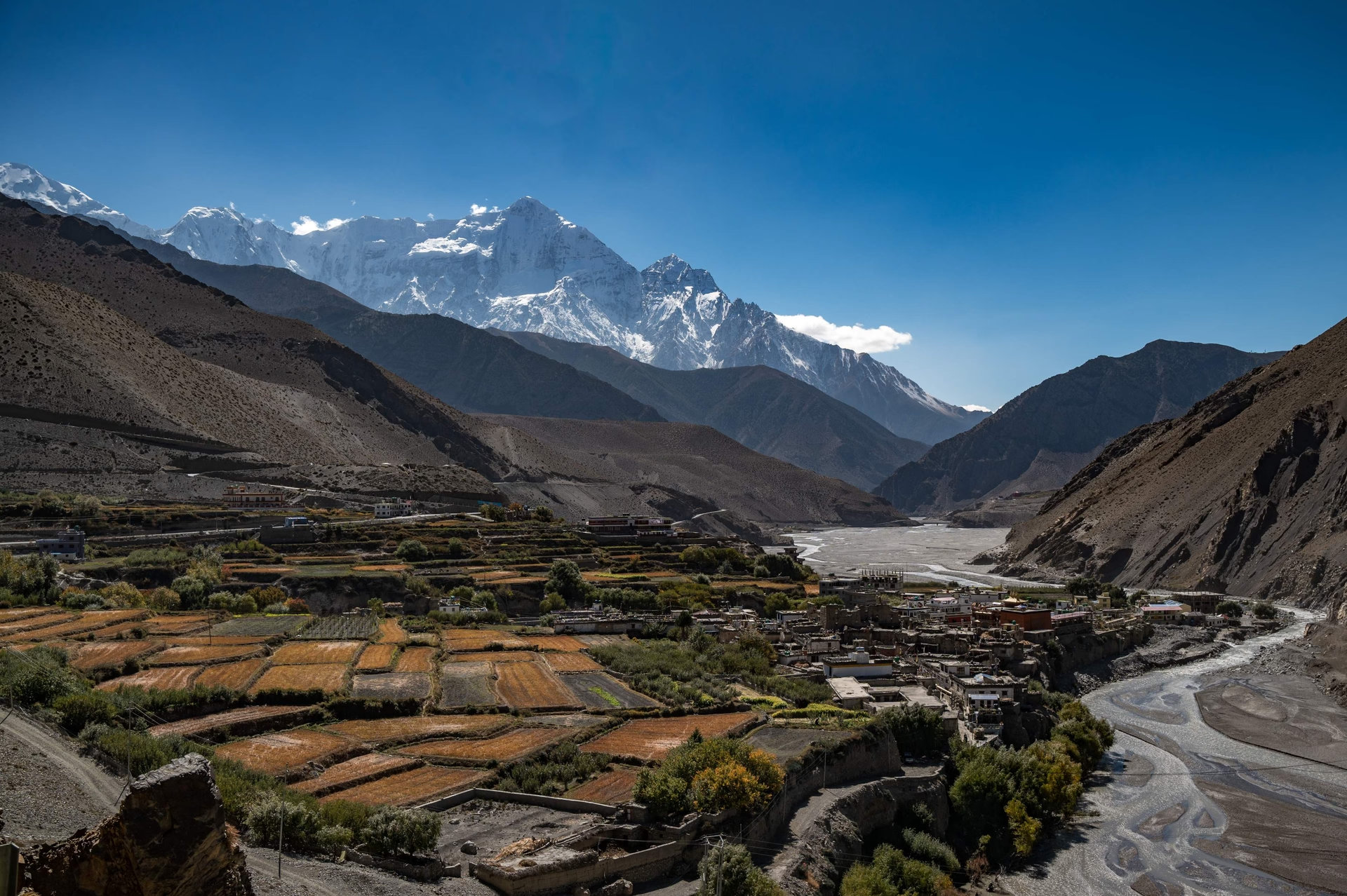
Muktinath weather in September reflects the transition from Nepal’s monsoon season to the clearer, drier conditions of autumn. At 3,800 meters (12,467 feet) in Mustang District, Muktinath experiences cool daytime temperatures of around 10°C–15°C (50°F–59°F) and cold nights near 0°C–5°C (32°F–41°F).
The Kali Gandaki Valley and the rain shadow created by the Annapurna and Dhaulagiri ranges keep Muktinath considerably drier than the lower Beni–Tatopani–Ghasa section, while strong afternoon winds become a defining feature around Jomsom and Kagbeni. September weather changes quickly with elevation, cloud cover, rainfall, and wind, making early-morning trekking the most reliable way to find clearer skies and stable trail conditions.
Trekking to Muktinath in September offers a combination of manageable high-altitude weather, improving Himalayan visibility, quieter trails, and fewer crowds before the peak October season. However, trekkers still need to prepare for afternoon rain, strong Kali Gandaki winds, cold nights, slippery lower trails, landslides, flash floods, thunderstorms, and occasional road or flight disruptions.
Proper layering, waterproof protection, suitable footwear, flexible transportation plans, and early daily starts are essential for handling these conditions. This guide explains September temperatures, rainfall patterns, wind behavior, mountain visibility, trail and travel risks, packing requirements, and the practical benefits of choosing Muktinath during this transitional trekking month.
How Warm or Cold Is Muktinath in September?
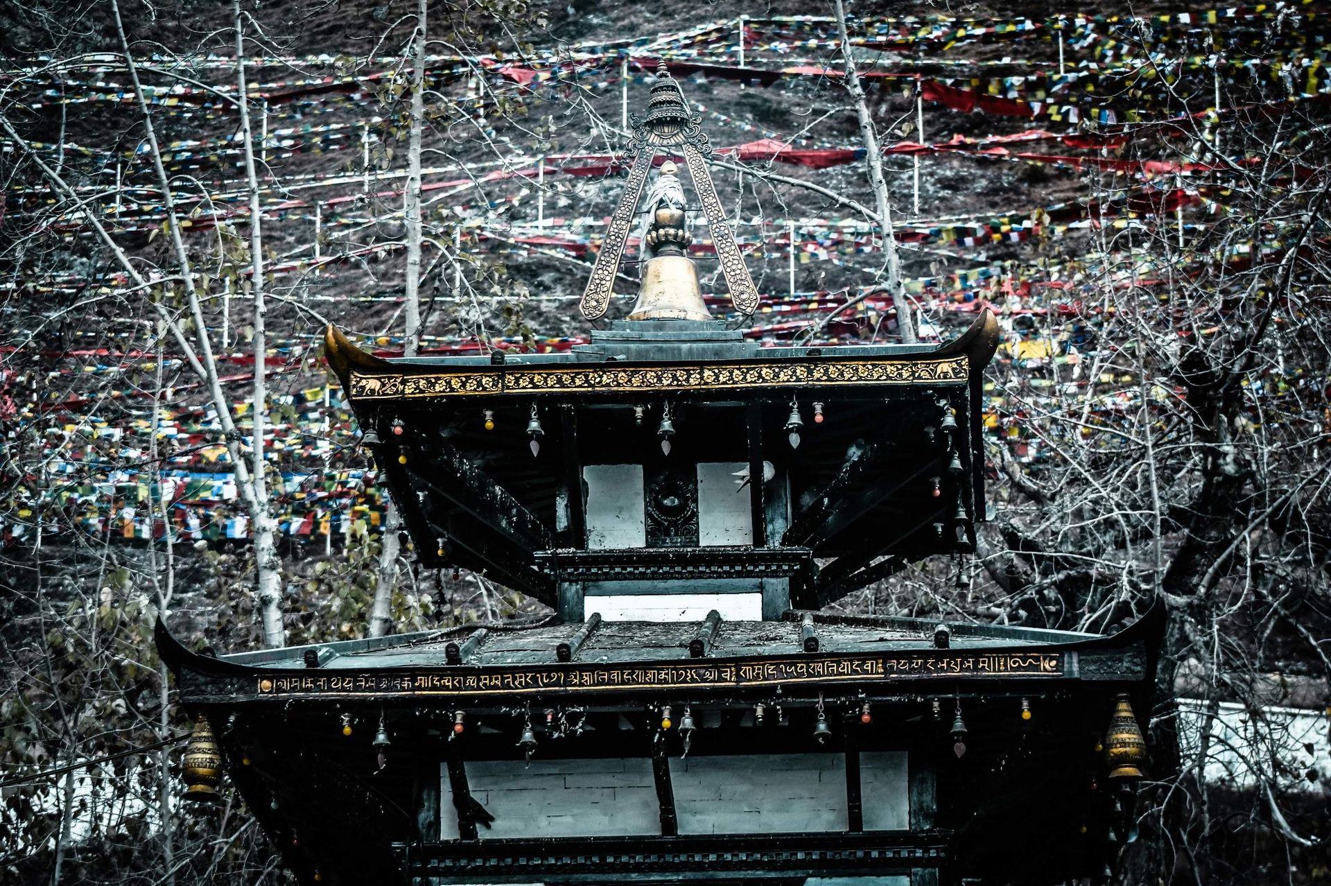
Muktinath temperatures in September average between 10°C and 15°C (50°F–59°F) during the day and drop to 0°C–5°C (32°F–41°F) at night. At 3,800 meters, the temperature difference between daytime warmth and nighttime cold spans roughly 12–15°C within a single 24-hour cycle. Trekkers who prepare only for daytime conditions routinely underestimate the severity of September nights at this altitude.
What Temperatures Can You Expect in Muktinath During September?
Daytime temperatures at Muktinath in September average 12°C (54°F), with peaks reaching 15°C on calm, sunny mornings in the second half of the month. The first two weeks of September tend to run 2–3°C warmer than the final two weeks, as the monsoon retreat accelerates from around September 20 onward and clearer air reduces the insulating effect of cloud cover.
The temperature corridor along the full trekking route varies dramatically by elevation zone:
Location | Elevation | Daytime High (Sept) | Night Low (Sept) |
Pokhara (trek start) | 822m | 26–28°C | 18–20°C |
Tatopani | 1,190m | 22–24°C | 14–16°C |
Ghasa | 2,010m | 18–20°C | 10–12°C |
Jomsom | 2,720m | 16–18°C | 7–9°C |
Kagbeni | 2,810m | 15–17°C | 5–8°C |
Muktinath | 3,800m | 10–15°C | 0–5°C |
These values reflect typical September conditions across the standard approach route. Temperatures on any specific day vary based on cloud cover, precipitation events, and wind speed at each location.
How Cold Does It Get at Night Around Muktinath?
Night temperatures at Muktinath in September reach 0°C–5°C (32°F–41°F), with occasional dips below 0°C during cold spells, especially after afternoon rainfall clears the sky and allows rapid overnight radiative cooling. The temperature drop accelerates after sunset and reaches its lowest point between 2:00 AM and 5:00 AM.
Teahouses and lodges at Muktinath typically provide 2 blankets per bed in September. Experienced trekkers bring a sleeping bag rated to -5°C for overnight stays at 3,800 meters, providing a critical buffer on the coldest nights. Sleeping bags rated only to +5°C or +10°C, marketed as "3-season" options, fall short of Muktinath's coldest September nights.
The coldest nights at Muktinath in September typically follow afternoon thunderstorms that clear the sky by 7:00 PM. These same cloud-free nights offer exceptional stargazing conditions at 3,800 meters, with atmospheric clarity that lower-altitude destinations cannot replicate. What most trekkers don't account for: wet clothing from afternoon rain combined with nighttime temperatures of 2°C creates rapid heat loss that dry -5°C conditions do not. Arriving at your teahouse with dry base layers every evening is a safety priority, not a comfort preference.
How Does Altitude Affect September Temperatures on Muktinath?
Altitude drops ambient air temperature by approximately 6.5°C for every 1,000 meters of elevation gain. Starting from Pokhara at 822 meters (26–28°C daytime) and ascending to Muktinath at 3,800 meters (10–15°C daytime), the net temperature reduction across the full trek spans approximately 15–16°C.
The altitude effect compounds with wind chill above 2,700 meters. A 12°C reading at Muktinath combined with a 25 km/h wind produces a feels-like temperature of 8°C. When valley winds exceed 40 km/h, standard for Jomsom afternoons, the effective temperature drops by an additional 5–8°C relative to the ambient reading.
Acclimatization directly influences your body's cold tolerance. Trekkers who ascend too quickly to 3,800 meters feel colder than thermometer readings indicate, because inadequate acclimatization impairs thermoregulation and reduces your body's capacity to generate and retain core heat.
A gradual ascent profile, gaining no more than 500 meters of sleeping altitude per day above 2,500 meters, keeps physiological heat production functioning at its baseline and lowers your risk of altitude sickness. Rushing the ascent to Muktinath in September means arriving cold, tired, and more vulnerable to hypothermia than the ambient temperature alone would suggest.
How Much Rain Does Muktinath Receive in September?
Muktinath receives approximately 40–60mm of rainfall in September, far less than destinations on the southern slopes of the Annapurna range, which receive 200–300mm during the same period. The Kali Gandaki Valley's unique geographic position creates a powerful rain shadow effect that shelters Muktinath and the Upper Mustang region from the full intensity of the South Asian monsoon system.
Is September Still Part of the Monsoon Season in Muktinath?
September falls within Nepal's monsoon season, which officially runs from June through September. The monsoon reaches peak intensity in July–August, then weakens progressively through September. By mid-September, rainfall frequency at Muktinath drops by approximately 40% compared to August levels. By late September, clear dry spells lasting 3–5 consecutive days become common at the 3,800-meter elevation.
The rain shadow effect produced by the Annapurna massif and Dhaulagiri (8,167m) intercepts moisture-laden air masses moving from the Bay of Bengal. This 8,000-meter geographic barrier forces precipitation onto the southern approaches, leaving the Mustang District in a drier zone than trekking routes south of the Annapurna range. Muktinath's September rainfall of 25–40mm compares to 180–220mm at Tatopani during the same month, a 5 to 7-fold difference across a single trekking route.
The monsoon retreat in Nepal typically extends into early October, DHM's 2025 monsoon report puts last year's actual withdrawal at October 10, eight days behind the long-term normal date, meaning late September trekkers should still expect lingering atmospheric moisture. Post-retreat conditions deliver rapid and measurable improvement in visibility, temperature stability, and trail drying rates.
How Often Does It Rain Along the Muktinath Trail?
Rainfall at Muktinath in September occurs on approximately 8–12 days of the month, compared to 15–18 rain days in August. The precipitation pattern follows a consistent diurnal cycle across the entire route: mornings are clear or partly cloudy from 6:00 AM to 12:00 PM, with cloud buildup and rain probability increasing sharply between 1:00 PM and 5:00 PM.
This afternoon rain pattern creates a reliable daily rhythm that experienced high-altitude guides follow precisely. Starting walks at 6:00 AM and reaching daily destinations before 1:00 PM is the standard practice on this route. Evening rain events clear overnight in most cases, restoring trail conditions and mountain views by the following morning.
Light drizzle, rather than heavy rainfall, accounts for the majority of September precipitation at Muktinath. Heavy rain events exceeding 10mm in a single day occur 1–2 times throughout September, typically linked to active monsoon troughs, while light afternoon drizzle accounts for the remainder of the month's precipitation.
Which Parts of the Muktinath Trail Are Most Affected by Rain?
The lower sections of the Muktinath trail, from Beni (830m) to Ghasa (2,010m), receive the highest September rainfall, averaging 80–120mm for the month compared to Muktinath's 25–40mm. This elevation band sits outside the rain shadow and directly intercepts monsoon precipitation from the Bay of Bengal weather system.
The trail between Tatopani and Ghasa crosses multiple side streams and traverses steep hillsides prone to waterlogging after rainfall. Stone steps along this section become slippery, trail edges show active erosion, and temporary stream crossings run high from upstream drainage. Trekkers walking this stretch in September regularly encounter 30–60 minutes of slower, more careful progress per trekking day compared to the dry season version of the same path.
Above Ghasa, and particularly above Marfa (2,670m), rainfall frequency and intensity drop sharply. The transition from monsoon-exposed lower valley to rain-shadow upper plateau happens across a surprisingly compressed 15–20 km stretch. Trekkers who navigate difficult wet conditions near Tatopani often emerge into clear skies and dry ground above Kagbeni, sometimes on the same afternoon.
Can Rain Cause Landslides or Trail Disruptions on Muktinath in September?
Landslides on the Muktinath route in September occur primarily between Beni and Ghasa, where steep hillsides receive heavy monsoon rainfall on unstable soil and fractured rock with limited vegetation anchoring. The 2024 monsoon season triggered 7 confirmed trail closures between Beni and Tatopani, requiring detours that added 3–6 hours to affected trekking days. The 2023 season saw similar disruption on this section. Landslides remain one of Nepal's most persistent monsoon hazards, the Ministry of Home Affairs' 2024 Disaster Report recorded 2,881 landslide incidents nationwide over a six-year span, underscoring why the Beni–Ghasa section's slope instability during active monsoon rainfall is a genuine, not anecdotal, trekking risk.
The route from Ghasa to Muktinath via Jomsom presents lower landslide risk than the lower approach but is not immune to disruption. Flash floods from side valleys, particularly around the Dana River confluence and the Ghasa side streams, temporarily block both the trail and the parallel jeep track. These flood events typically subside within 4–6 hours and are predictable enough that local guides avoid these crossings during and immediately after heavy upstream rainfall.
Checking trail conditions with local teahouse owners the night before each trekking day provides the most reliable real-time information available. The TIMS (Trekkers' Information Management System) checkpoint at Jomsom distributes morning condition updates to permit holders. No smartphone weather app replicates the accuracy of a Jomsom teahouse owner's next-day assessment.
What Is September Weather Like Along the Muktinath Trail?
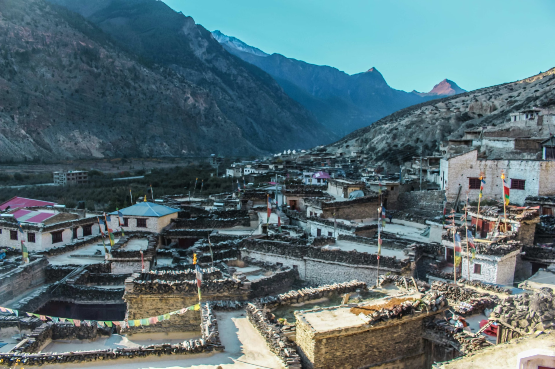
September weather on the Muktinath trail ranges from warm and partly cloudy in lower elevations to cool, clear, and frequently windy above Kagbeni. The trail traverses 5 distinct climate zones across its 3,000-meter elevation gain from Pokhara to Muktinath, and the weather character changes meaningfully approximately every 800 meters of altitude.
How Does Weather Change Between Lower and Higher Elevations of Muktinath?
The lower Kali Gandaki valley from Beni to Tatopani is humid, warm, and frequently overcast in September, with daytime temperatures reaching 22–24°C and afternoon rain occurring on 12–15 days of the month. The forested hillsides along this stretch retain moisture from monsoon saturation, keeping relative humidity between 70–85% throughout the day.
The middle section from Ghasa to Jomsom marks the transition from humid monsoon-affected terrain to the high-altitude plateau of Mustang. Vegetation visibly shifts from dense subtropical forest near Ghasa to scattered juniper and scrubby highland grasses near Marfa and Jomsom. Humidity drops to 40–55% in this zone, cloud patterns become more predictable, and afternoon rain events shorten in duration even as wind increases in speed.
The upper section from Kagbeni to Muktinath enters the edge of the Upper Mustang region, the most dramatic landscape on the entire route, a rugged semi-arid plateau with eroded ochre rock formations, Tibetan-style monastery walls, and expansive sky. September conditions here deliver clear mornings, building afternoon cumulus over the peaks, and occasional afternoon showers that rarely exceed 20–30 minutes in duration before clearing.
What Weather Can You Expect Around Jomsom and Kagbeni?
Jomsom (2,720m) receives 16–18°C daytime temperatures in September with relatively low rainfall of 30–50mm for the month. Its position at the mouth of the Kali Gandaki gorge, flanked by Dhaulagiri (8,167m) to the west and Annapurna I (8,091m) to the east, creates powerful thermal wind patterns that dominate the afternoon weather experience at this specific location. Jomsom's airport runway, oriented north-south along the gorge axis, regularly closes by 11:00 AM when valley winds exceed safe operating limits.
Kagbeni (2,810m) sits 12 km north of Jomsom and serves as the gateway to Upper Mustang. September temperatures mirror Jomsom closely, but Kagbeni experiences even less rainfall because of its deeper position inside the rain shadow. The ancient village's narrow mud-brick lanes create natural wind channels that concentrate the valley wind, making exposed areas of Kagbeni feel significantly colder than the open-air thermometer reading when strong afternoon winds are active.
The 6 to 7-hour walk from Jomsom to Muktinath via Kagbeni begins across a broad alluvial gravel plain before ascending sharply through eroded badlands terrain and cultivated apple orchards near Jharkot. This ascent section, covering 990 meters of elevation gain from Kagbeni at 2,810m to Muktinath at 3,800m, runs warm and calm in the morning before valley winds develop after 11:00 AM.
How Windy Is the Trail to Muktinath in September?
The Kali Gandaki valley generates afternoon wind speeds that routinely reach 40–60 km/h between 11:00 AM and 4:00 PM, making it one of the most reliably windy trekking corridors in the entire Himalayan region. The thermal mechanism driving this wind is well-documented in Himalayan meteorological literature: a WRF-modeled wind study of the Kali Gandaki Valley found that simulated valley-axis winds compare closely with ground observations, with parts of the 70 km corridor around Jomsom rated as having outstanding wind power potential.
Wind exposure varies significantly by trail position and time of day. The exposed gravel plains between Jomsom and Kagbeni bear the full force of these valley winds. The walled village of Kagbeni provides natural shelter. The ascent trail from Kagbeni toward Muktinath angles eastward away from the valley floor, gradually reducing direct wind exposure while altitude-related cold increases.
September winds at Muktinath itself average lighter than at Jomsom, the temple complex and surrounding ridgeline provide natural shelter from the main valley wind channel. Average wind speeds at Muktinath during September afternoons range from 15–30 km/h, occasionally gusting to 45–50 km/h during active weather systems. Trekkers arriving at Muktinath before 11:00 AM consistently experience calmer conditions than those arriving after 1:00 PM.
Is Visibility Usually Good on Muktinath for Mountain Views?
Morning visibility at Muktinath is excellent on approximately 60–65% of September days, with clear sightlines to Dhaulagiri (8,167m), Thorong Peak (6,144m), Tilicho Peak (7,134m), and the Annapurna massif. The remaining 35–40% of September mornings present partly cloudy conditions that still allow intermittent mountain views between cloud gaps.
The optimal viewing window runs from 6:00 AM to 10:00 AM before thermal cloud development begins. By 11:00 AM, cumulus clouds frequently build around the high peaks and obscure summit views from the valley floor. By 2:00 PM, cloud cover at Muktinath is often complete. These afternoon clouds typically dissipate by 5:30–6:00 PM, restoring mountain views for golden-hour light before sunset.
Late September delivers noticeably superior visibility compared to early September. The retreating monsoon in the final 10 days of the month reduces atmospheric moisture loading, increasing the frequency of crystalline-clear mornings with exceptional definition on distant ridgelines. Trekkers who time their Muktinath arrival for September 22–30 consistently report better mountain photography conditions than those arriving in the first two weeks of the month.
Is Muktinath Trekking Safe in September?
Muktinath trekking in September is safe for physically fit, well-equipped trekkers with proper local guidance. The primary weather-related risks are landslides on lower trail sections, afternoon thunderstorms above 2,500 meters, hypothermia from wet-cold combinations at altitude, and flash flooding at side stream crossings. Each of these risks is manageable with correct preparation and route timing. Annapurna Conservation Area visitor data shows just how crowded the region can get at its peak, foreign arrivals topped roughly 181,576 in 2019 alone, which is exactly the kind of congestion September's quieter shoulder-season trails let you avoid.
What Weather-Related Risks Should Trekkers Expect on Muktinath?
The 4 primary weather risks on the Muktinath trail in September are landslides on the Beni–Ghasa section, afternoon thunderstorms above 2,500 meters, hypothermia from wet and cold exposure combinations, and flash flooding at side stream crossings.
Landslides carry the highest consequence risk but are geographically confined to the lower 40 km of the trail. Experienced guides know the specific active landslide zones on the current year's route and schedule crossings of vulnerable sections before afternoon rainfall increases slope instability.
Afternoon thunderstorms above 2,500 meters develop rapidly, typically within 30–45 minutes from first cloud formation to lightning-active storm. Trekkers caught on exposed ridgelines or high passes during electrical storms face genuine danger from lightning strikes. The descent from Thorong La pass to Muktinath, following the standard counter-clockwise Annapurna Circuit route, warrants specific vigilance for afternoon storm development.
Hypothermia at Muktinath most commonly affects trekkers who arrive wet from afternoon rain and then encounter rapid temperature drops after sunset. Wet synthetic or cotton clothing at 3,800 meters in 2–3°C nighttime conditions causes heat loss approximately 3 times faster than equivalent dry conditions. Carrying dry base layers in a sealed waterproof bag inside your pack, never in external pockets or loose in the main compartment, prevents the scenario that leads most September hypothermia cases at this altitude.
How Can You Prepare for Sudden Rain or Strong Winds on Muktinath?
Preparing for sudden September weather changes on the Muktinath trail requires 3 specific daily actions: carrying a packable rain jacket at all times on the trail, scheduling daily walks to arrive at destinations before 1:00 PM, and wearing windproof outer layers as soon as you enter the Jomsom–Muktinath zone above 2,700 meters.
A packable rain jacket with a minimum 10,000mm hydrostatic head rating and a sealed hood weighing under 350 grams is the single most consequential item in a September Muktinath packing kit. It deploys in under 60 seconds and simultaneously addresses rain penetration and wind chill. Trekkers who stow rain jackets in pack main compartments, requiring pack removal to access, consistently get caught in rain before the jacket is on.
Wind preparedness above Jomsom specifically requires lightweight wind pants over trekking trousers and a fleece buff or neck gaiter that seals the gap between jacket collar and chin. The combination of valley wind and residual moisture at 2,700–3,800 meters drives heat loss approximately 3 times faster than calm air at the same ambient temperature.
Monitoring the previous evening's weather behavior, specifically whether clouds cleared completely by sunset, indicating good overnight drainage, provides directional guidance for the next morning's conditions. Local lodge owners in Jomsom who manage 30–50 years of observational experience at this specific microclimate location routinely provide more accurate next-day predictions than any commercially available smartphone weather application.
What Should You Do During Poor Weather on the Muktinath Trail?
During poor weather on the Muktinath trail, the 3 correct responses are: shelter immediately in the nearest teahouse or stone structure, avoid all exposed ridgelines and high passes until the weather system passes, and communicate your position and status to your guide or trekking agency contact.
Waiting out afternoon rain at the nearest teahouse before resuming the trail when the system clears, typically 60–90 minutes, is the established local practice on this route. Teahouses are spaced at intervals of 90 minutes to 2 hours along the entire Muktinath approach, meaning sheltering never costs more than a 2–3 hour total delay on any trekking day.
The Annapurna Conservation Area Project (ACAP) maintains weather observation points with daily condition reports at checkpoints in Jomsom, Kagbeni, and Muktinath. Trekkers holding valid ACAP permits receive weather and trail condition briefings at these checkpoints during active weather events.
Attempting to push through bad weather on the Muktinath trail is the most common poor decision trekkers make in September. The consequences range from arriving wet and cold at altitude, directly increasing hypothermia risk, to navigating trail hazards that monsoon rain, fog, and poor visibility obscure from standard sightlines.
How Does September Weather Affect Road and Flight Conditions on Muktinath?
September weather disrupts jeep road access on the Beni–Jomsom highway approximately 6–10 days per month due to landslide debris blocking the road surface, flood damage to river crossings, or rain-softened road sections that collapse under vehicle weight. The Jomsom airport, the primary air access point for the Mustang region, experiences flight cancellations on 8–14 mornings in September due to low cloud ceilings in the Kali Gandaki valley approach corridor.
Mountain flights from Pokhara to Jomsom operate exclusively in the early morning window from 6:00 AM to 10:00 AM before valley cloud development closes the visual flight path. September cancellations occur frequently enough that any itinerary relying on the Pokhara–Jomsom flight as a fixed logistics element requires minimum 2 buffer days at Pokhara to absorb weather delays without disrupting the trekking schedule.
The jeep road from Beni to Jomsom provides an alternative to both flying and the full trekking approach. In September, road conditions extend the standard 6–8 hour jeep journey to 8–12 hours, with river crossings at several points along the route becoming impassable on 2–4 days per month following heavy upstream rainfall events.
What Should You Pack for Muktinath in September?
The optimal September packing list for Muktinath, drawn from our general Nepal trekking packing list, addresses 3 functional requirements: a layering system that handles the 0°C–25°C temperature range from trail start to high-altitude night, waterproof protection for both the trekker and the gear, and traction footwear for wet rock, mud, and dry rocky terrain above Kagbeni. Total pack weight excluding water and daily consumables targets 8–12 kg for self-supported trekkers and 5–7 kg for porter-supported expeditions.
Which Clothing Layers Are Best for Changing Temperatures?
A 3-layer clothing system handles Muktinath's September temperature range most effectively:
Base layer: Merino wool long-sleeve top (150–200gsm weight) or synthetic moisture-wicking equivalent
Mid layer: 300gsm fleece jacket or 700-fill-power down jacket with water-resistant shell
Outer layer: Waterproof, windproof hardshell jacket with taped seams, adjustable hood, and pit zip venting
The layering system functions because temperatures drop drastically over your multi-day ascent, ranging from 25°C in Pokhara to 5°C on evenings in Muktinath. Trekkers must constantly add or remove layers to manage microclimates throughout each trekking day. Merino wool base layers perform specifically well in September because they regulate body temperature across a wider thermal range than synthetic alternatives and resist odor over multiple days of high-exertion use without laundering.
Lower body layering follows the same three-layer principle: convertible trekking trousers or standard trekking pants as the primary layer, thermal leggings for cold evening and early-morning conditions, and lightweight wind pants as an outer layer specifically for the Jomsom–Muktinath section.
Glove layering warrants specific attention. Lightweight liner gloves, merino or silk, worn under waterproof shell gloves address the full September hand temperature range at Muktinath, from 18°C on sunny mid-morning lower trails to 0°C on wind-exposed ridgelines in the afternoon. Single-layer gloves that work at one extreme consistently fail at the other.
Do You Need Waterproof Trekking Gear in September?
Yes, waterproof gear is essential for the Muktinath trek in September. The minimum waterproof kit includes: a hardshell jacket with minimum 10,000mm hydrostatic head rating, a waterproof pack rain cover, and waterproof internal dry bags for electronics, documents, sleeping bag, and a dry change of clothing.
The 10,000mm hydrostatic head rating ensures the jacket repels sustained heavy rainfall rather than becoming saturated and transferring moisture to base layers. Jackets rated below this threshold become ineffective within 20–30 minutes of sustained rain, the exact scenario you encounter on the Beni–Ghasa section during active monsoon events.
Pack rain covers protect the external shell from rain but do not prevent water from pooling in the pack base during heavy downpours or river crossings. Dry bags inside the pack provide the internal waterproofing that external covers cannot guarantee. Sleeping bag wet-out at 3,800 meters is a genuine safety issue, not a comfort inconvenience, a saturated down sleeping bag loses 80–90% of its insulation value.
Which Footwear Works Best on Wet and Rocky Trails?
Mid-cut waterproof hiking boots with a Vibram rubber sole rated for wet rock deliver the best all-conditions performance on the September Muktinath trail. The mid-cut height, covering the ankle to 8–10 cm above, prevents ankle twists on the rocky, uneven terrain above Kagbeni while supporting controlled descents on wet stone steps and mud sections below Ghasa.
Gore-Tex lining or equivalent waterproof membrane technology waterproofs the boot from external moisture while maintaining breathability during sustained aerobic ascents. Boots without waterproof membranes become fully saturated on the lower Kali Gandaki trail within 2–4 hours of rain exposure, dramatically increasing blister risk from wet sock friction and reducing thermal insulation at Muktinath's cold overnight temperatures.
Trail runners with waterproof uppers are an acceptable alternative for lightweight trekkers who prioritize descent speed and agility over maximum ankle support. This footwear choice is appropriate for the upper sections above Jomsom on dry ground but carries higher ankle injury risk on the loose, rocky lower trail after rain.
Short gaiters, the sock-height style covering boot collar to mid-shin, prevent mud and small stones from entering boot openings during the muddy trail sections between Tatopani and Ghasa. They weigh under 200 grams and deliver disproportionate comfort improvement on wet trail days compared to their minimal pack weight cost.
What Rain Protection Should You Carry?
Carry 3 complementary forms of rain protection for the September Muktinath trek: a packable hardshell rain jacket, a compact trekking umbrella, and a waterproof pack rain cover. Each serves a distinct function within a complete rain protection system.
The rain jacket is the primary defense during active trekking through rain, providing both waterproofing and windproofing. A lightweight trekking umbrella, the compact aluminum-pole design used by 70–80% of experienced Himalayan trekkers, provides overhead protection that a jacket hood cannot: it keeps the face, neck, and shoulder area dry during sustained downpours and doubles as sun protection from intense UV radiation on the high-altitude exposed terrain above Kagbeni.
Waterproof phone pouches and camera bags protect electronic devices that standard pack rain covers cannot reliably shield during heavy rain or unexpected trail water crossings. A lightweight dry bag (10L) dedicated to documents, passport, and a dry set of base layers completes the internal waterproofing strategy.
What Are the Benefits of Trekking to Muktinath in September?
September trekking to Muktinath delivers 3 distinct advantages unavailable in peak-season months: reduced trail and teahouse congestion, lower accommodation and guide costs, and the visual richness of a landscape fed by monsoon greenery before the October dry season arrives. These advantages represent real experiential value for trekkers who prioritize authentic encounters over statistically optimal weather.
Can September Offer Clear Himalayan Views on Muktinath?
Muktinath delivers clear Himalayan views on 60–65% of September mornings. The key peaks visible from the Muktinath temple complex and the surrounding plateau ridgeline include Dhaulagiri (8,167m), Thorong Peak (6,144m), Yakawa Kang (6,482m), Tilicho Peak (7,134m), and the Annapurna massif's western face.
What most trekking itineraries don't mention: late September sunrises at Muktinath produce some of the most visually dramatic light conditions of the entire trekking year. The retreating monsoon atmosphere retains enough residual moisture particles to scatter golden and amber light across the Himalayan panorama during the first 30–45 minutes after sunrise. This atmospheric transition-period light, a product of post-monsoon air rather than the dry-season clarity of October, produces mountain photography conditions that statistically clearer October mornings don't replicate.
The practical viewing strategy at Muktinath in September: reach the temple complex by 6:00 AM and observe weather development across the 6:00–10:00 AM window. This 4-hour period consistently delivers at least 90 minutes of unobstructed peak visibility on days classified as partly cloudy, because high-altitude cloud development in September rarely covers the full sky until late morning.
Are Muktinath Trails Less Crowded in September?
Muktinath trails in September carry approximately 35–45% fewer trekkers than October, the route's peak month. The reduction in traffic produces 4 measurable practical benefits: shorter queues at Muktinath temple puja ceremonies, more available teahouse rooms without advance booking requirements, faster permit processing at ACAP checkpoints, and substantive interactions with Mustang families without the commercial-atmosphere overlay of peak-season crowds.
The Muktinath temple complex, sacred to both Hindu pilgrims who venerate Vishnu and Buddhist practitioners who recognize the site as a Tibetan Buddhist shrine, receives significantly fewer visitors in September than during major religious festivals in October and November. Trekkers visiting in September experience the temple with the contemplative atmosphere its pilgrimage significance deserves.
Teahouse accommodation costs at Jomsom, Kagbeni, and Muktinath run 20–30% lower in September than October rates. Porter and guide daily rates track approximately 10–15% lower. These cost reductions compound across a 10-day itinerary to produce meaningful total savings, particularly for group treks where guide, porter, and accommodation costs represent the majority of total expenditure.
What Makes September Different From Other Trekking Months?
September combines the green monsoon-fed landscape with emerging post-monsoon clarity in a combination no other trekking month produces on the Muktinath route. The Kali Gandaki hillsides between Ghasa and Jomsom display millet fields in harvest gold, the apple orchards of Marfa carry ripe fruit ready for the October harvest festival, and fresh snow occasionally dusts the peaks above 5,500 meters after September cold fronts, a visual combination that October's dry brown landscape cannot offer.
October delivers more statistically consistent weather and higher clear-morning rates (80–85% compared to September's 60–65%). November produces the clearest air of the trekking year but bare hillsides, absent harvests, and nighttime temperatures approaching -10°C at Muktinath. August offers the most dramatic green but the highest rainfall and trail disruption frequency.
September's specific weather character, transitional, dynamic, and visually rich, suits experienced trekkers who understand mountain weather behavior and value authentic immersion over guaranteed optimal conditions, see our roundup of the best treks for September if Muktinath is one stop on a wider itinerary. The trade-off is honest: you accept more weather variability in exchange for fewer crowds, lower costs, and a landscape that reflects the mountains' living seasonal cycle.
How Can Heaven Himalaya Help You Prepare for Muktinath Weather?
Heaven Himalaya specializes in custom Muktinath trekking itineraries that account for September's specific weather patterns, trail disruption risks, and permit requirements. The team draws on direct field experience of the Kali Gandaki valley's September microclimate to build routes that maximize your clear-weather trekking windows and minimize exposure to September's primary risk zones.
Planning a September Muktinath trek requires more than applying a standard itinerary to a new month. Teahouse availability along the transitional shoulder-season window, early-morning departure scheduling to exploit clear morning weather, weather contingency rest-day positioning, and permit logistics for the TIMS and ACAP systems all require coordination by an operator with current September-specific field knowledge.
Can Heaven Himalaya Help You Choose the Right Muktinath Itinerary?
Heaven Himalaya offers 3 distinct Muktinath itinerary structures for September trekkers:
10-day standard trek from Pokhara: the most weather-resilient structure, building 2 rest-day buffers to absorb landslide delays on the lower route and flight delays at Jomsom
7-day jeep-assisted combination trek: combines jeep transport on the Beni–Jomsom road with focused high-altitude trekking above Kagbeni, reducing lower-route monsoon exposure
12-day extended circuit with Upper Mustang access: for trekkers who want to explore the restricted-area plateau north of Kagbeni, including Lo Manthang, within a September departure framework. Trekkers approaching Muktinath via Thorong La instead can find full route details on our Annapurna Circuit trek page
Heaven Himalaya's licensed guides carry certified wilderness first aid training and maintain daily radio contact with Jomsom-based field coordinators who monitor trail conditions, weather developments, and checkpoint updates across the entire route. Every September Muktinath group receives a pre-departure weather briefing covering the available 10-day forecast and specific risk points relevant to their departure date.
Contacting Heaven Himalaya before booking your September Muktinath trek provides access to real-time trail condition reports, local gear rental recommendations in Pokhara, and an itinerary calibrated specifically to September's weather window, not a year-round generic schedule applied to a month it doesn't fit. Ready to go? Explore our Jomsom to Muktinath Trek package for a route built around this exact itinerary.
What Are the Key Takeaways About Muktinath Weather in September?
September weather at Muktinath is manageable, dynamic, and rewarding for trekkers who prepare with accuracy. The following 8 facts summarize the essential weather knowledge for planning your September Muktinath trek:
Daytime temperatures at Muktinath (3,800m) in September range from 10°C–15°C (50°F–59°F).
Nighttime temperatures drop to 0°C–5°C (32°F–41°F), with occasional sub-zero dips after afternoon storms clear the sky.
Rainfall at Muktinath totals 25–40mm in September, approximately 5–7 times less than the southern Annapurna approaches, due to the Kali Gandaki rain shadow effect.
The lower trail sections from Beni to Ghasa receive the heaviest September rainfall (80–120mm) and carry the highest landslide risk on the route.
Morning trekking hours from 6:00 AM to 1:00 PM deliver the safest, clearest, and most weather-stable conditions across the full route.
Afternoon winds in the Kali Gandaki valley reach 40–60 km/h between 11:00 AM and 4:00 PM, requiring windproof outer layers above Jomsom.
Clear mountain views occur on 60–65% of September mornings at Muktinath, improving significantly in the final 10 days of the month after monsoon retreat.
September trails carry 35–45% fewer trekkers than October, delivering lower costs, greater teahouse availability, and a more authentic cultural experience at Muktinath.
September rewards trekkers who engage with the mountain on its own terms. The weather demands more active management than October, earlier starts, precise layering, constant readiness for afternoon rain, and a genuinely flexible mindset around daily scheduling. In return, it delivers a Muktinath experience that combines harvest-season landscape color, post-monsoon light quality, genuine solitude at one of Nepal's most significant sacred sites, and access to a trail that the rest of the world hasn't yet arrived to share.