

Top 10 Off-the-Beaten-Path Treks in Nepal for Real Adventurers

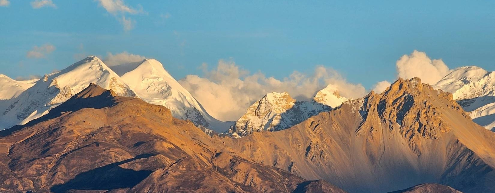
Off-the-beaten-path treks in Nepal are remote Himalayan adventures that take trekkers beyond the crowded Everest, Annapurna, and Langtang routes into isolated valleys, traditional mountain settlements, and unspoiled alpine landscapes. The best remote treks in Nepal include the Manaslu Circuit, Upper Mustang, Kanchenjunga Base Camp, Nar Phu Valley, Dolpo, Makalu Base Camp, Rara Lake, Tsum Valley, Panch Pokhari, and Rolwaling Valley.
These trails reveal a different side of the Himalayas, from ancient Tibetan Buddhist monasteries and sacred pilgrimage lakes to glacial valleys, high mountain passes, rare wildlife habitats, and communities that preserve centuries-old traditions.
Choosing the right off-the-beaten-path trek in Nepal depends on your available time, physical fitness, altitude experience, preferred landscapes, and budget. Shorter adventures such as Rara Lake and Panch Pokhari offer remote mountain experiences within approximately 7–10 days, while Kanchenjunga Base Camp, Upper Dolpo, and other demanding Himalayan expeditions can require several weeks, camping logistics, and careful acclimatization.
Some routes also require restricted-area permits, registered trekking agencies, and licensed guides. This guide explores the highlights, cultural experiences, difficulty levels, trekking durations, best seasons, permit costs, and safety considerations for all 10 destinations, helping you compare Nepal's less-traveled trails and plan an adventure that matches your experience and expectations.
1. Manaslu Circuit Trek: An Untouched Himalayan Gem
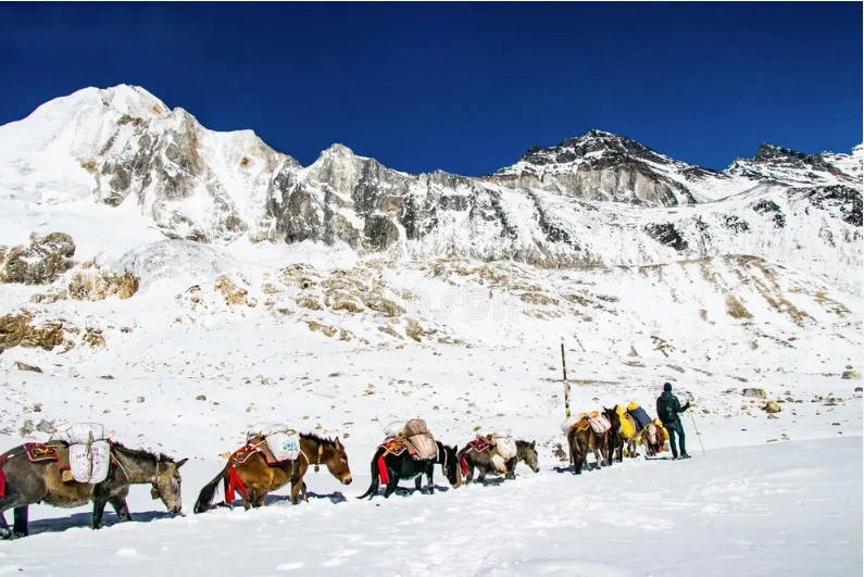
The Manaslu Circuit is a 177 km loop around Mount Manaslu (8,163 m), the eighth highest mountain on Earth. It follows the Budhi Gandaki river through Gorkha district and crosses Larkya La at 5,106 m.
What Are the Main Highlights of the Manaslu Circuit Trek?
The 4 main highlights are the Budhi Gandaki gorge, the Tibetan-Buddhist villages of Nubri, Pungyen Gompa, and the Larkya La crossing. The Nubri villages of Lho, Shyala, and Samagaun (3,530 m) keep mani walls and chorten gates that border isolation preserved. Pungyen Gompa sits above 4,000 m under the Manaslu north face, and Birendra Lake (3,450 m) is a short walk from Samagaun.
Most people overlook the lower valley. Days 1 to 4 pass bamboo forest, waterfalls, and suspension bridges, and the Tibetan influence in house design and dress becomes visible above Deng (1,860 m).
How Difficult Is the Manaslu Circuit Trek, and How Long Does It Take?
The Manaslu Circuit is a moderate-to-strenuous trek of 14 to 18 days, and Larkya La day is the hardest. That day runs 8 to 10 hours from Dharamsala (4,460 m) up 646 m to the pass, then down 1,516 m to Bimthang (3,590 m). Start at 3 or 4 am, because wind builds by late morning.
According to the TravelHealthPro altitude illness factsheet, which summarizes Wilderness Medical Society guidance, trekkers above 3,000 m should raise their sleeping elevation by no more than 500 m per day, take a rest day every three to four days, and add an extra acclimatization day for every 1,000 m gained. Skipping the Samagaun rest day to save a day is the most common cause of turnbacks at Dharamsala.
What Permits and Guides Are Required for the Manaslu Circuit Trek?
Manaslu requires 3 permits: the Restricted Area Permit (USD 100 for 7 days from September to November, USD 75 from December to August), the Manaslu Conservation Area Permit (NPR 3,000), and the Annapurna Conservation Area Permit (NPR 3,000) near Dharapani.
Extra days cost USD 15 each in peak season, so a 10-day stay inside the restricted zone costs USD 145. A registered agency applies at the Department of Immigration in Kathmandu, and a licensed guide is mandatory. Independent trekking is not permitted.
When Is the Best Time to Trek the Manaslu Circuit?
The best time to trek the Manaslu Circuit is September to November and March to May. October brings the clearest skies and the fullest lodges, and beds at Samagaun and Dharamsala fill by mid-afternoon. April and May add rhododendron bloom in the lower valley.
Night temperatures at Dharamsala fall to between -5 and -10 degrees Celsius in November. Larkya La closes after heavy snowfall between December and February. The monsoon months bring leeches and landslides on the Budhi Gandaki trail, so we avoid them.
2. Upper Mustang Trek: The Forbidden Kingdom
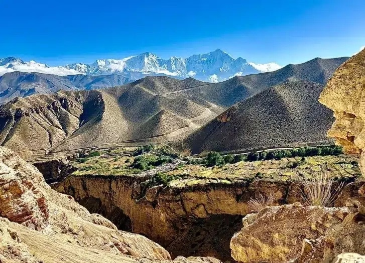
Upper Mustang is the northern half of Mustang district, a trans-Himalayan desert on the Tibetan border. Foreigners were barred until 1992, and the walled capital Lo Manthang (3,840 m) still anchors the route.
What Makes Upper Mustang's Desert Landscapes and Ancient Monasteries Unique?
Upper Mustang is unique because it combines a rain-shadow desert with 15th-century monasteries inside a single 10 to 14 day trek. The Himalaya block monsoon clouds, so the valley shows red cliffs, wind-carved canyons, and eroded pinnacles instead of forest. Ghar Gompa near Ghami (Lo Gekar) is credited to the 8th-century teacher Padmasambhava.
Thubchen Gompa and Jampa Lhakhang in Lo Manthang hold 15th-century murals. The Chhoser cave complex, with its multi-level sky caves, is the stop most itineraries rush through. We schedule time there.
How Can Trekkers Experience Tibetan Culture in Upper Mustang?
Trekkers experience Tibetan culture in Upper Mustang through monastery visits, family lodges, and the Tiji festival. Lo Manthang was founded in 1380 by Ame Pal, and the Kingdom of Lo kept its titular monarchy until 2008. The Loba people follow the Sakya school of Tibetan Buddhism. Tiji, a 3-day masked-dance festival, takes place each spring, usually in May, inside the Lo Manthang walls.
Stay in family-run lodges, sample butter tea and tsampa, and attend the morning prayers at Chode Gompa. Festival dates follow the Tibetan lunar calendar and shift every year.
What Are the Restricted Area Permit Requirements for Upper Mustang?
Upper Mustang requires a Restricted Area Permit following a November 2025 Cabinet decision reported by The Kathmandu Post, the Upper Mustang Restricted Area Permit is now charged at USD 50 per person per day with no 10-day minimum, plus the Annapurna Conservation Area Permit (NPR 3,000). It is among the most expensive permits in Nepal. A 12-day trek therefore costs USD 600 in restricted-area fees alone.
According to Nepal's immigration rules, a registered agency and a licensed guide are mandatory. The jeep road to Lo Manthang is open, but we route trekkers along the older eastern trail to avoid the dust and traffic.
When Is the Best Time to Explore Upper Mustang?
The best time to explore Upper Mustang is April to October, including the monsoon months. Mustang sits in the Himalayan rain shadow, so June to August stay mostly dry while the rest of Nepal is soaked. May suits trekkers who want the Tiji festival. September and October bring the sharpest light.
Winds build in the Kali Gandaki gorge after 10 am in every season, so we start walking at 7 am. Winter temperatures drop below -15 degrees Celsius, and most lodges in Lo Manthang close.
3. Kanchenjunga Base Camp Trek: Into the Wild East
Kanchenjunga (8,586 m) is the third highest mountain in the world and stands on the Nepal-India border. Its trek in Taplejung district is the longest and most remote base camp route in Nepal.
What Can Trekkers See on the North and South Kanchenjunga Base Camp Routes?
The North route reaches Pangpema (5,143 m), and the South route reaches Oktang (4,730 m), each facing a different side of Kanchenjunga. Pangpema sits below the north face and the Kanchenjunga glacier. Oktang, above Ramche, looks across the Yalung glacier. The full circuit connects both through high passes, including Sele La and Sinion La, in 22 to 25 days.
The region also holds Pathibhara Devi temple (3,794 m), a Hindu pilgrimage site near Phungling. Most trekkers choose one side. The circuit rewards those with 3.5 weeks.
How Difficult Is the Kanchenjunga Base Camp Trek?
Kanchenjunga is a strenuous trek because of its length, remoteness, and long days of 6 to 9 hours on rough trail. The route climbs and drops repeatedly through river valleys before the high camps at Kambachen (4,050 m) and Lhonak (4,780 m). Lodges thin out above Ghunsa, and many nights are in basic rooms.
Landslides closing the lower trail are the biggest scheduling risk in the monsoon tail of September. We add 2 buffer days to every departure. Evacuation from Pangpema takes hours by helicopter weather permitting and days on foot.
What Wildlife and Mountain Views Make Kanchenjunga Base Camp Trek Special?
Kanchenjunga is special because the Kanchenjunga Conservation Area protects snow leopards, red pandas, Himalayan black bears, musk deer, and blue sheep across 2,035 square kilometers. According to the Department of National Parks and Wildlife Conservation's Kanchenjunga Conservation Area brochure, the area was established in 1997 at 1,650 km2, was later extended to 2,035 km2, and has been managed by a local community council since 2006.
Rhododendron and bamboo forest fill the lower slopes, and cardamom terraces surround the first villages. The summit panorama includes Jannu (7,710 m) and Kabru. The Limbu, Rai, and Sherpa communities along the trail run the lodges and the village homestays, which keeps income local.
What Permits and Acclimatization Plans Are Needed for Kanchenjunga?
Kanchenjunga requires a Restricted Area Permit (USD 20 per person per week) and a Kanchenjunga Conservation Area Permit (NPR 3,000), both issued through a registered agency. A licensed guide is mandatory. According to the Wilderness Medical Society, 500 m of sleeping elevation per day above 3,000 m is the ceiling.
Our plan places rest days at Ghunsa and Kambachen and adds one at Lhonak before Pangpema. The most common mistake is flying into Taplejung and rushing the first 6 days, arriving at 4,000 m with tired legs and no adaptation.
4. Nar Phu Valley Trek: A Hidden Himalayan World
Nar Phu is a pair of Tibetan-style villages in a gorge north of the Annapurna Circuit in Manang district. Foreigners have been allowed in since 2002, and no road reaches either village.
What Traditional Villages and Landscapes Can Trekkers Discover in Nar Phu Valley?
Trekkers discover the stone-walled villages of Phu (4,080 m) and Nar (4,110 m), the Tashi Lhakhang monastery in Phu, and the deep Nar Phu gorge that links them. Phu's houses cluster against a cliff, and the monastery above the village is roughly 400 years old.
The gorge walls turn orange and ochre in afternoon light. Blue sheep graze the slopes, and snow leopard tracks appear in winter snow. Residents keep yak herds and barley fields, and they speak a Tibetan dialect.
How Does the Nar Phu Valley Trek Compare With the Annapurna Circuit?
Nar Phu is quieter, harder, and more remote than the Annapurna Circuit, and it exits over Kang La (5,306 m), a pass 110 m lower than Thorong La (5,416 m). According to the Annapurna Conservation Area Project, foreign visitors to the area numbered 191,666 in 2023, and a vehicle road now reaches Chame and Khangsar on the circuit.
Nar Phu has no road, fewer lodges, and a longer stretch without resupply. Pair the two by walking Nar Phu first, then rejoining the circuit at Ngawal for Thorong La. This adds 6 days.
What Are the Trekking Difficulty and High-Pass Challenges on Nar Phu Valley Trek?
Nar Phu is a strenuous 12 to 14 day trek whose main challenge is the steep Kang La approach and a long descent to Ngawal. Kang La Phedi camp is basic, and the pass day lasts 8 to 9 hours. Fresh snow in April and November hides the trail, so a guide who knows the route is essential.
We schedule a rest day in Phu. Acclimatize on the way up from Koto (2,600 m) and avoid compressing the first 4 days, because the valley gains over 1,400 m before Phu.
Which Permits and Seasons Are Best for Nar Phu Valley?
Nar Phu requires a Restricted Area Permit (USD 100 for the first 7 days from September to November, USD 75 from December to August, and USD 15 per extra day in autumn or USD 10 in the off-season, per the Department of Immigration schedule reported by The Kathmandu Post) and the Annapurna Conservation Area Permit (NPR 3,000). A registered agency and a licensed guide are mandatory.
The best seasons are April to May and September to November. April snow can block Kang La early in the month, so we prefer late April. October gives the most stable weather. Winter closes the pass, and the monsoon makes the lower canyon trail slippery.
5. Dolpo Trek: Mystical Land of the Himalayas
Dolpo is a trans-Himalayan plateau in far west Nepal and the core of Shey Phoksundo National Park, the largest national park in Nepal at 3,555 square kilometers. Upper Dolpo opened to foreigners in 1989.
What Makes Upper Dolpo and Lower Dolpo Different?
Lower Dolpo is a 14 to 16 day trek around Phoksundo Lake and Dho Tarap, and Upper Dolpo is a 20 to 28 day trek across 3 passes above 5,000 m to Shey Gompa and Saldang. Lower Dolpo stays mostly below 4,500 m and has the better trail. Upper Dolpo sits deeper in the Tibetan plateau and costs far more in permits.
Choose Lower Dolpo for 2 weeks and a first remote camping trek. Choose Upper Dolpo for 4 weeks and real isolation.
How Do Shey Phoksundo Lake and Ancient Tibetan Buddhist Traditions Shape the Dolpo Trek?
Shey Phoksundo Lake (3,611 m) is one of the deepest lakes in Nepal at 145 m, and Bon and Buddhist traditions shape every village on the trail. The turquoise water sits below the 167 m Suligad waterfall near Ringmo village. Shey Gompa, the Crystal Monastery at about 4,500 m, is a pilgrimage site for both Bon and Buddhist followers.
Peter Matthiessen walked the same Crystal Mountain route in 1973 and wrote The Snow Leopard. Villagers pass Bon prayer flags and chortens counterclockwise, the reverse of Buddhist custom, so follow their direction.
What Are the Main Challenges of Trekking in Dolpo?
The main challenges in Dolpo are altitude, camping logistics, flight delays, and zero rescue access. Most trek days exceed 4,000 m, and Kang La (5,360 m), Numa La (5,190 m), and Baga La (5,070 m) come in sequence. No lodges exist beyond Phoksundo, so a crew of cooks, guides, and porters or mules carries food and fuel for the whole trip.
Flights to Juphal via Nepalgunj run late in poor weather. We add 2 buffer days and require helicopter-evacuation insurance valid to 6,000 m.
How Much Do Dolpo Trekking Permits and Logistics Cost?
Upper Dolpo requires a Restricted Area Permit of USD 500 for the first 10 days and USD 50 for each extra day, plus the Shey Phoksundo National Park permit (NPR 3,000). Lower Dolpo carries a far smaller restricted-area fee, around USD 20 per person per week.
A 20-day Upper Dolpo trek therefore costs USD 1,000 in restricted-area fees. Add 2 domestic flights (Kathmandu to Nepalgunj, Nepalgunj to Juphal), a camping crew, and insurance. Dolpo is the most expensive trek on this list per day.
6. Makalu Base Camp Trek: For the True Explorer
Makalu (8,485 m) is the fifth highest mountain on Earth and stands inside Makalu Barun National Park. The trek follows the Barun valley in Sankhuwasabha district, and its base camp sits at 4,870 m.
What Himalayan Landscapes and Mountain Views Await on the Makalu Trek?
The Makalu trek crosses 3 landscape belts: subtropical hills, rhododendron and oak forest, and the glacial Barun valley under Makalu's pyramid. The route leaves Tumlingtar, climbs through Num and Seduwa, and crosses Shipton La (4,216 m).
Peaks around the base camp include Chamlang (7,321 m) and Baruntse (7,129 m). Barun Pokhari, a glacial lake, sits below the main face. The trek starts near Tumlingtar (about 460 m), so the vertical gain to base camp exceeds 4,000 m.
How Difficult Is the Route to Makalu Base Camp?
The route to Makalu Base Camp is strenuous and takes 18 to 22 days, with steep climbs of up to 1,500 m on single days. The first week climbs repeatedly from river to ridge. After Tashigaon (2,100 m), the last permanent village, accommodation moves to basic lodges and then camps. Weather turns quickly in the Barun valley.
Fit trekkers who have completed Annapurna or Langtang routes are the right match. Common mistake: underestimating the Shipton La section, which has loose scree and bad footing after rain.
What Wildlife and Remote Communities Can Trekkers Encounter on Makalu Base Camp Trek?
Makalu Barun National Park protects 25 rhododendron species, about 440 bird species, red pandas, snow leopards, and Himalayan black bears across 1,500 square kilometers. Established in 1992, it joins Sagarmatha National Park and Tibet's Qomolangma reserve into a continuous protected zone. Rai and Sherpa families farm the lower valleys around Num and Tashigaon.
Their millet beer and yak cheese appear at most homestays. Birdwatchers see Himalayan monal and blood pheasant on the upper trail, and the quiet there is unusual for Nepal.
When Is the Best Season for the Makalu Base Camp Trek?
The best seasons for the Makalu Base Camp Trek are March to May and October to November. Spring brings rhododendron bloom through the middle valley. October and November give the clearest mountain views.
The park permit costs NPR 3,000, and your agency arranges local entry fees. Monsoon trails turn to leech-heavy mud, and winter snow blocks Shipton La.
7. Rara Lake Trek: The Jewel of the West
Rara Lake is the largest lake in Nepal, covering 10.8 square kilometers at 2,990 m in Mugu district. The surrounding Rara National Park, established in 1976, is the smallest national park in the country at 106 square kilometers.
What Makes Rara Lake and Rara National Park Worth Exploring?
Rara is worth exploring because it is a 167 m deep alpine lake surrounded by pine, spruce, and juniper forest and almost no other tourists. The water changes from blue to green with the light, and snow peaks reflect on calm mornings.
According to the Department of National Parks and Wildlife Conservation, the park hosts 214 bird species along with Himalayan black bears, musk deer, red pandas, and Himalayan tahr. Rara sees far fewer visitors than any park on the Everest or Annapurna circuits, so camp spots by the shore are usually empty.
Which Villages, Forests, and Mountain Trails Can Trekkers Discover?
Trekkers discover the Sinja valley, Jumla's apple orchards, Gamgadhi, and the Murma Top viewpoint (3,710 m). Sinja valley was the capital of the medieval Khas Malla kingdom and is regarded as the birthplace of the Nepali language. Jumla farms Jumli Marshi rice at 2,500 m, one of the highest rice terraces on Earth.
The Jumla to Rara route crosses ridges of blue pine and rhododendron. Murma Top gives the best view over the lake and the snow ranges beyond it. Walk the Jumla approach when time allows.
How Difficult Is the Rara Lake Trek, and How Many Days Are Needed?
The Rara Lake Trek is easy to moderate and takes 7 to 10 days from Jumla, or 4 to 5 days as a loop from Talcha airport, which sits a few hours' walk from the lake. Daily walks run 5 to 7 hours, and the highest point is Murma Top at 3,710 m. Altitude sickness is rare but real above 3,500 m.
Both access routes need a domestic flight through Nepalgunj, and flights cancel often. Build 1 spare day at each end. Rara suits first-time remote trekkers, families with older children, and anyone who wants a quiet trek in under 2 weeks.
When Is the Best Time to Visit Rara Lake?
The best time to visit Rara Lake is March to May and September to November. Spring shows rhododendron forest, and autumn gives the cleanest air and reflections. The monsoon (June to August) disrupts flights and trails. Winter edges of the lake freeze from December to February, and snow closes the high passes.
Entry costs NPR 3,000 for the Rara National Park permit, and no restricted-area permit applies. Camp near the shore in autumn, since lodge options are limited.
8. Tsum Valley Trek: The Sacred Hidden Valley
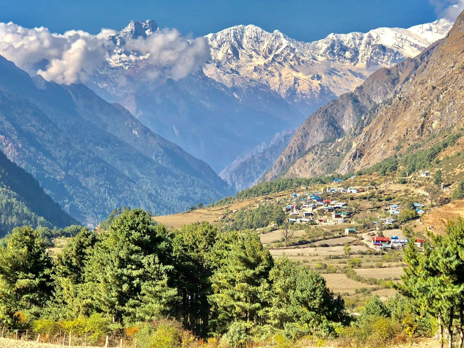
Tsum Valley is a Tibetan Buddhist valley in northern Gorkha, branching off the Manaslu Circuit at Lokpa. Locals call it Beyul Kyimolung, the "hidden valley of happiness."
What Makes Tsum Valley's Buddhist Monasteries and Traditions Unique?
Tsum Valley is unique because its monasteries follow a strict non-violence tradition, with no hunting and no killing of animals. Rachen Gompa (3,240 m) is a nunnery, and Mu Gompa (3,700 m) sits close to the Tibetan border. Milarepa's Cave (Piren Phu) draws pilgrims who follow the 11th-century yogi's teachings.
The Tsumba people preserve old Tibetan dialect, dress, and household customs, including traditional polyandry. Tsum opened to foreign trekkers only in 2008, so lodges still feel like family homes.
Which Villages and Himalayan Landscapes Are Highlights of the Tsum Valley Trek?
The highlights are Chhokangparo (3,010 m), Nile (3,361 m), Mu Gompa, and views of Ganesh Himal, Sringi Himal, and Baudha Himal. Chhokangparo is the valley's biggest village and a good base for side trips. Nile, with its rope bridge and border-facing houses, is the last settlement before Tibet.
The route passes through pine forest, barley terraces, and walls of mani stones that run for hundreds of meters. According to Nepal Traveller, in June 2026, the upper valley still has no reliable mobile signal.
How Difficult Is the Tsum Valley Trek for First-Time Remote Trekkers?
Tsum Valley is a moderate-to-strenuous trek of 14 to 18 days, and its low maximum altitude of 3,700 m makes it the gentlest remote option on the list. The steep, landslide-prone section is the Budhi Gandaki gorge between Soti Khola and Jagat. Lodges are basic but available throughout, so no camping is needed.
Altitude sickness risk is lower than on Manaslu. We recommend Tsum for trekkers with one prior multi-day trek, for example Poon Hill or Langtang, who want a remote experience without a high pass.
What Permits and Seasonal Conditions Should Trekkers Know About Tsum Valley Trek?
Tsum Valley requires a Tsum Valley Restricted Area Permit (USD 40 for the first week from September to November, USD 30 from December to August, and USD 7 per day beyond a week, per the Department of Immigration schedule reported by The Kathmandu Post) and the Manaslu Conservation Area Permit (NPR 3,000). The Annapurna permit (NPR 3,000) applies when the route exits toward Dharapani.
A registered agency and a licensed guide are mandatory. The best seasons are March to May and September to November. Winter brings heavy snow above Chhokangparo. The monsoon makes the gorge trail unstable.
9. Panch Pokhari Trek: Five Sacred Lakes
Panch Pokhari is a cluster of 5 high-altitude lakes at 4,100 m in the Jugal Himal of Sindhupalchok district. It is the closest remote trek to Kathmandu on this list, reached in about a day by road.
What Is the Religious and Cultural Significance of Panch Pokhari?
Panch Pokhari is sacred to both Hindus and Buddhists, and thousands of pilgrims walk to the lakes every year for the Janai Purnima festival in August. Hindu tradition links the 5 lakes to the Pandava brothers of the Mahabharata and to Lord Shiva.
Buddhist visitors link them to Guru Rinpoche. Pilgrims bathe, leave offerings, and camp beside the water for the full-moon night. Outside that week, the lakes are almost empty. Plan around the festival, or avoid August entirely.
Which Mountain Views and Natural Landscapes Can Trekkers Experience on Panch Pokhari Trek?
Trekkers see Dorje Lakpa (6,966 m), Langtang Lirung (7,227 m), and, on clear days, Shishapangma (8,027 m) across the Tibetan border. The trail climbs through rhododendron and oak forest, passes terraced villages, and opens into alpine meadows with yak grazing. The lakes sit in a glacial bowl, with ice-rimmed water through spring.
Sindhupalchok was among the districts hit hardest by the 2015 earthquake, and the lodges along the route have reopened and rely on trekker income.
How Difficult Is the Panch Pokhari Trek, and How Long Does It Take?
The Panch Pokhari Trek is moderate and takes 7 to 9 days, with 5 to 7 hours of walking each day. The ascent from the forest line to the lakes at 4,100 m is steep, and altitude sickness appears at the top for unprepared trekkers.
Sleep at Panch Pokhari only after a night at 3,600 m or lower. Lodges are simple, and some departures use camping. The trek works as a 10-day warm-up for Rolwaling or Tsum. It also suits trekkers with limited time.
When Is the Best Time to Visit Panch Pokhari?
The best time to visit Panch Pokhari is March to May and September to November. Spring offers rhododendron bloom and warm afternoons, and autumn offers clear mountain views. August draws the Janai Purnima pilgrims, with crowds, tents, and noise at the lakes.
The rest of the monsoon brings leeches and cloud. Winter snow covers the final 3 hours of the climb, and lodges close. Panch Pokhari lies outside the restricted zones, so no restricted-area permit applies and your agency handles trek registration.
10. Rolwaling Valley Trek: The Land of Yeti Legends
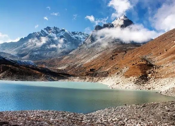
Rolwaling is a glacier valley in Dolakha district inside the Gaurishankar Conservation Area, which covers 2,179 square kilometers. Its Sherpa villages sit between Gaurishankar (7,134 m) and the Tibetan border.
What Makes Rolwaling Valley's Glaciers, Villages, and Mountain Views Unique?
Rolwaling is unique because it combines Tsho Rolpa glacial lake (4,580 m), the Sherpa village of Beding (3,690 m), and a seven-thousander skyline in one valley. Tsho Rolpa is one of the largest glacial lakes in Nepal, and engineers lowered its water level in 2000 to reduce flood risk.
Beding and Na (4,180 m) preserve Rolwaling Sherpa houses of dark stone. Gaurishankar, sacred to Shiva and Parvati, rises above the valley, though the summit is hidden from the village itself.
How Challenging Is the Rolwaling Valley Trek and Tashi Lapcha Pass?
The Rolwaling Valley trek to Tsho Rolpa is strenuous over 14 days, and adding Tashi Lapcha Pass (5,755 m) makes it technical, with 18 to 22 days to reach Khumbu. The pass needs crampons, an ice axe, a harness, and rope. Trekkers cross the Drolambau glacier before the rope section.
Fixed experience with glacier travel is a requirement, not a suggestion. The base trek suits strong trekkers. The pass suits those with alpine skills and a climbing guide. We turn people away from the pass when experience is missing.
What Cultural Traditions and Yeti Legends Can Trekkers Discover on Rolwaling Valley Trek?
Trekkers discover Rolwaling Sherpa culture at Beding Gompa and the Yeti legend of the Menlung glacier. In 1951, mountaineer Eric Shipton photographed large footprints on the Menlung glacier near Gaurishankar, which sparked decades of expeditions.
Rolwaling villagers tell Yeti stories passed down by herders, and the local belief ties the creature to Menlungtse (7,181 m). Visit Beding Gompa for its prayer wheels and monks' chanting. The Yeti stories are folklore, and the real discovery is the Sherpa hospitality that comes with them.
What Permits, Guides, and Safety Preparations Are Required for Rolwaling Valley?
Rolwaling requires the Gaurishankar Conservation Area Permit (NPR 3,000) and a Restricted Area Permit for the Lamabagar area, priced around USD 10 per person per week on 2026 agency schedules. Tashi Lapcha adds the Sagarmatha National Park permit (NPR 3,000) and the Khumbu local entry fee (NPR 2,000).
A licensed guide is mandatory, and a climbing guide is essential for the pass. Insurance must cover helicopter evacuation above 5,500 m. Carry a satellite messenger, since mobile coverage ends below Beding.
How Can Heaven Himalaya Help You Plan an Off-the-Beaten-Path Trek in Nepal?
Heaven Himalaya plans off-the-beaten-path treks in Nepal by arranging restricted-area permits, licensed guides, domestic flights, and acclimatization-first itineraries. Restricted-area permits are issued only through registered agencies, so the Department of Immigration paperwork is part of the booking.
We match the route to your fitness and calendar, schedule rest days at the right altitudes, and place buffer days around flights to Juphal, Talcha, Tumlingtar, and Bhadrapur. Fees on this page follow 2026 schedules. Rates change without notice, and we confirm each figure before you pay.
Can Heaven Himalaya Customize a Remote Nepal Trek to Match Your Adventure Goals?
Yes, Heaven Himalaya customizes remote Nepal treks by length, group size, accommodation style, and combination of routes. Common requests include pairing Tsum Valley with Manaslu, adding Nar Phu to the Annapurna Circuit, or shortening Dolpo to the Lower circuit.
We also run private departures for couples, families, and photographers who want slower pacing. Tell us your dates, your highest previous altitude, and the experience you want, and we propose a route with permit costs, flight plans, and an honest difficulty rating.
What Should You Remember When Choosing Your Ideal Off-the-Beaten-Path Trek in Nepal?
Choose an off-the-beaten-path trek in Nepal by matching 4 factors: days available, highest altitude you have already reached, permit budget, and season. With 7 to 10 days, pick Rara Lake or Panch Pokhari. With 2 weeks, pick Nar Phu, Tsum Valley, or Manaslu. With 3 to 4 weeks and camping experience, pick Kanchenjunga, Makalu, Dolpo, or Rolwaling.
Upper Mustang suits trekkers who want culture over altitude, in any month from April to October. Every restricted-area route needs a registered agency and a licensed guide. The best off-the-beaten-path treks in Nepal reward careful planning, and the empty trails are the proof.