Samdo is a high-elevation remote village in Nepal. It's one of the stopping points for hikers on the Manaslu Circuit Trek, located in the Gorkha District of Gandaki Province in western Nepal.
It's the last settlement of the trek, where adventurers can find warm shelter for an overnight stay. It comes a day before the main and highest point of the journey, Larkya La (also known as Larke Pass), rising to 5,106 m (16,751 ft).
After this village, the next stop is Dharmashala (4,450 m/14,599 ft), which is just a place with tea houses. And it isn't exactly a human settlement.
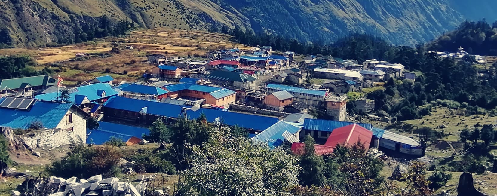
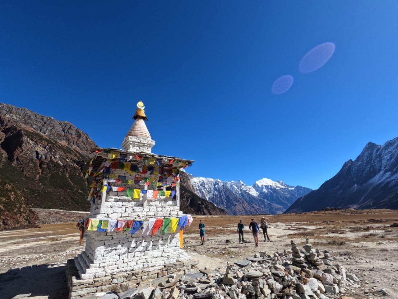
Once you enter the Samdo, you'll find yourself in a different world. The area comprises a small monastery, stone-built houses, mani walls (stones inscribed with Buddhist mantras), and Buddhist prayer flags.
It's essential to learn about each place you'll go through or visit during the Manaslu Trek. Therefore, let's study Samdo Village together. By the end of this blog, you'll have a better knowledge of the last permanent village, its worth, altitude, and local culture and lifestyle.
What Is The Altitude of Samdo
Samdo is situated at 3,875 m (12,717 ft) above sea level, close to the border of Nepal-Tibet (China). The oxygen level is lower here compared to plain terrain. Thus, during trekking, you might find it harder to breathe than in your regular place, especially if you're from sea level.
Risk of Altitude Sickness
Altitude sickness starts at 2,500 m (6,562 ft), and Samdo is already above that altitude. At such a height, the risk of altitude sickness is very high.
If you reside at sea level or are trekking for the first time, you'll find it hard to breathe because your body struggles to adjust to the lower air pressure. In such a circumstance, if you hike or ascend in a rush, you may develop one of the symptoms of altitude sickness in your body, such as:
- Headache (most common)
- Loss of appetite
- Trouble sleeping
- Fatigue or unusual tiredness
- Nausea or vomiting
- Shortness of breath
- Dizziness
- Swelling of hands, feet, or face (in some cases)
Safety Tips To Avoid Altitude Sickness
- Walk slowly and take frequent breaks of 5 to 7 minutes each.
- Drink enough water, at least 3 to 4 litres a day. Also, eat an apple and a cucumber daily, as they are high in water.
- Consider eating mainly foods that contain high carbs, such as bread, potatoes, pasta, lentils, and rice.
- Spend an extra day in Sama Gaun (3,530 m/11,581 ft), a typical village best known for acclimatisation, which comes right before Samdo.
- Take acetazolamide (brand name Diamox), but only after consulting your doctor.
- Eat garlic soup with timur (Sichuan Pepper) in your meal. Garlic and Timur are the best home remedies to avoid altitude sickness.
Accommodation and Food In Samdo Village
Regarding accommodation, there are enough hotels and tea houses available, operated by locals. Some of them are Samdo Guest House, Larkya Lodge, and Himalayan Lodge.
All these hotels in the village provide basic modern facilities, including electricity, hot showers, and internet. Even though the facilities aren't as strong and smooth as those in the hotels in the cities, at least they've made such things available in such a remote and high-altitude location for us.
To use a hot shower, charge gadgets, and Wi-Fi, you'll need to pay extra. Just a little extra, not much. Nevertheless, for charging your electronic devices, we strongly recommend bringing a power bank instead of relying solely on the facilities available there.
In food, there are a variety of options available on the menu, from local cuisines (dal bhat, momo, chowmein, etc.) to western cuisine. You can have a meal of your choice during your stay in Samdo Village.
Culture And Lifestyle In Samdo
Samdo is inhabited by descendants of Tibetan refugee settlers, mainly Bhotia/Khampa. For that reason, Buddhism is the only religion followed in the area. You'll find a small monastery, spinning prayer wheels, the mani walls, prayer flags, and chortens on your visit.
The place is so culturally rich. The locals burn incense every morning in their house and visit the monastery as a part of their culture. They strongly believe in spirituality and work to keep it alive from generation to generation.
Speaking of their lifestyle, they're engaged in agriculture, cultivating barley and potatoes. However, summer lasts for a shorter period of the year, making cultivation limited.
They're highly dependent on yak herding. They use yak for dairy, produce wool, and transport supplies.
Day Hikes And Acclimatization Excursions From Samdo Village
Samdo is also famous for acclimatization during the Manaslu Trek, along with Sama Gaun. Not every hiker spends an extra day in Sama Gaun to acclimatise their body. Some go directly from Lho Gaun (3180 m/10433 ft) to Samdo via Sama Gaun (3530m / 11581 ft).
During acclimatization day, tourists hike to either Samdo Ri (5,177 m/16,985 ft) or the Tibetan Border (Lajyang Bhanjyang, 5,030 m/16,503 ft). Doing so helps you adjust to the lower oxygen level and prepare for further elevation, especially to the Larke Pass.
Samdo Ri is a peak, but you don't need to climb it. You can hike up to 4,800 to 5,000 m (15,748 to 16404 ft), which most trekkers do.
It takes approximately 3 hours from your hotel in Samdo to the peak and return. From the high spot, you can enjoy the views of Mount Manaslu, other peaks and even some parts of Tibet.
On the other hand, the journey to Lajyang Bhanjyang is like a full-day hike. It takes around 7 to 8 hours for the round trip.
Weather And Best Time To Visit Samdo
Since Samdo lies at a high elevation in Nepal, cold temperatures are common here, even in summertime. Not too cold like in winter, but colder than other lower-altitude places in the country. When the weather is good and sunny, days are warm, but nights can still be cold.
When it comes to the best time to visit Samdo, spring (March to May) and autumn (September to November) are the ideal seasons. The reasons are as follows:
Spring
- The temperatures are mild, with 10 to 12°C in the day and -2 to 5°C at night.
- Skies get clear, allowing you to witness the best mountain views.
- Winter snow and ice on the trail melt.
- Wildflowers bloom, making the route colourful.
- All the hotels and lodges stay open.
Autumn
- Dust and haze are washed away by monsoon rain.
- The weather is stable.
- The days are cool, with temperatures of 8 to 10°C, and the nights are cold (but manageable with proper gear), often -5 to 0°C.
- Mostly clear skies, allowing you to enjoy the spectacular views of mountains, valleys, and villages.
- The trail appears green and beautiful.
- The route turns dry, making hiking more enjoyable.
- All the hotels and lodges stay open.
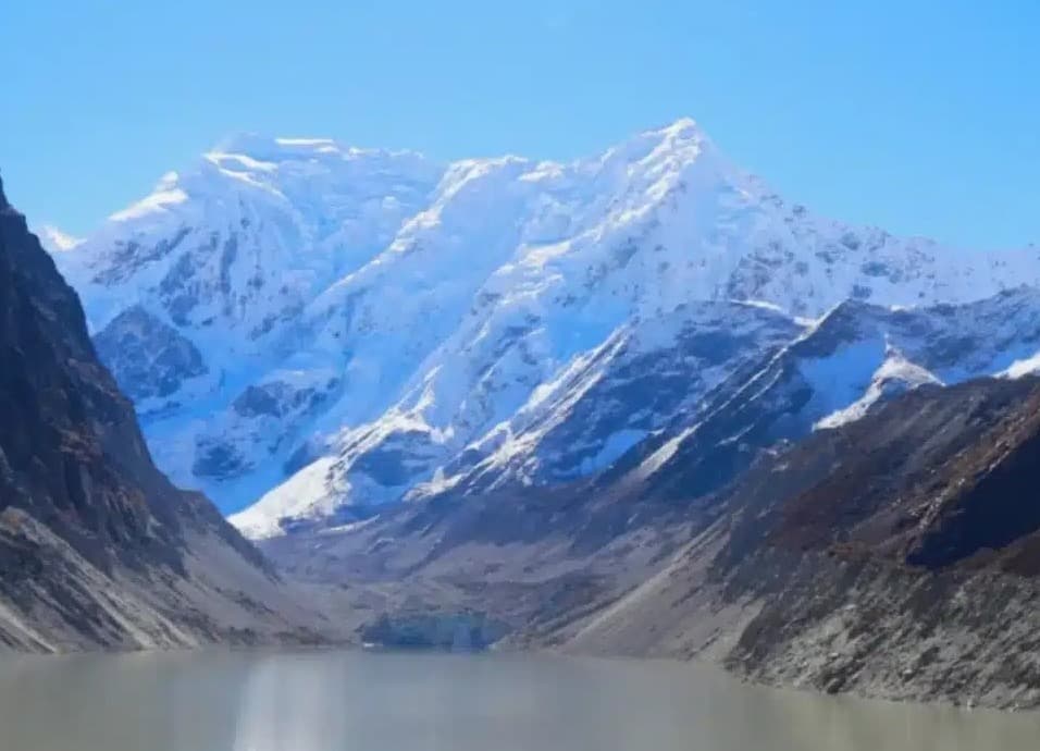
Distance From Samdo To Larkya La Pass
As stated earlier, Samdo is the last village on the Manaslu Circuit Trek. It's just a day away from the main point, Larkya La.
Between these two places, there's Dharmashala, also known as Larkya Base Camp. The following day of your stay in Samdo, you don't go directly to the main point. You'll stay for a night in Dharmashala first, and the next day, early in the morning, you'll leave for the Larke Pass.
Samdo To Dharmashala
Dharmashala stands at an elevation of 4,450 m (14599 ft), and it isn't exactly a village or human settlement. It's just another stopping point before crossing the Larke Pass.
The distance from Dharmashala to Samdo is roughly 6 to 7 km and generally takes 3 to 4 hours of walking at a normal pace. The trail is also not technically demanding.
There are only four basic tea houses available in the entire area. They provide only food and lodging. We can't expect to have electricity, a hot shower, and an internet connection.
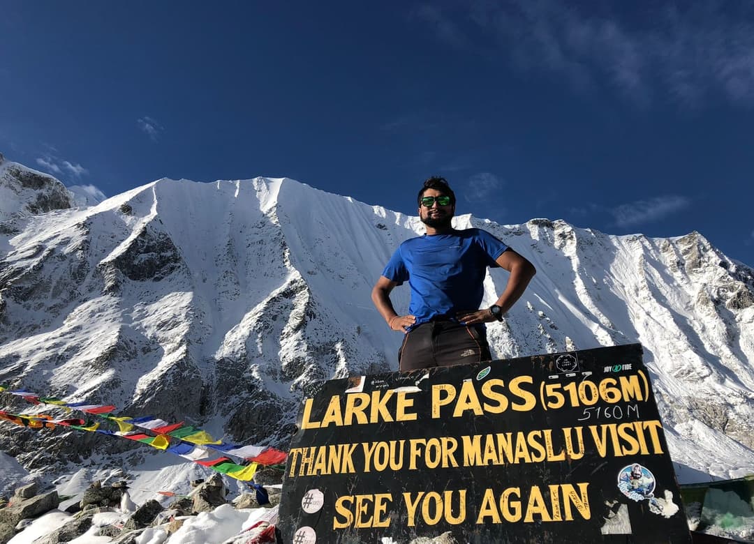
Larkya La Crossing
On the day of crossing Larkya La (Pass), you will need to wake up early at 4 A.M. and leave the tea house in Dharmashala at 5 A.M. Doing so helps you avoid strong winds at the pass, which usually happen in the late morning and also bad weather. At high elevations in Nepal, the weather is so unpredictable and can change at any time.
It typically takes 3 to 4 hours to reach the Larke Pass from Dharmashala. Upon reaching the pass, you'll spend just 10 to 15 minutes observing the stunning views of the peaks, such as follows:
- Himlung (7,126 m/23,379 ft)
- Cheo Himal (6,820 m/22,375 ft)
- Kang Guru (6,981 m/22,904 ft)
- Annapurna II (7,937 m/26,040 ft)
After that, you'll need to hike for 4 to 5 hours more to reach your destination for an overnight stay, Bhimthang (3,590 m/11,778 ft) in Manang.
The route from Dharmashala to Bhimthang via Larkya La is moderate, with rocky ground. Speaking of difficulty, it's not too hard to hike.
The only thing that might make you feel hard is the duration. During this, you'll hike approximately 8 to 9 hours.